| As the age-old adages say,
“A picture is worth a thousand words” and “Seeing is believing”,
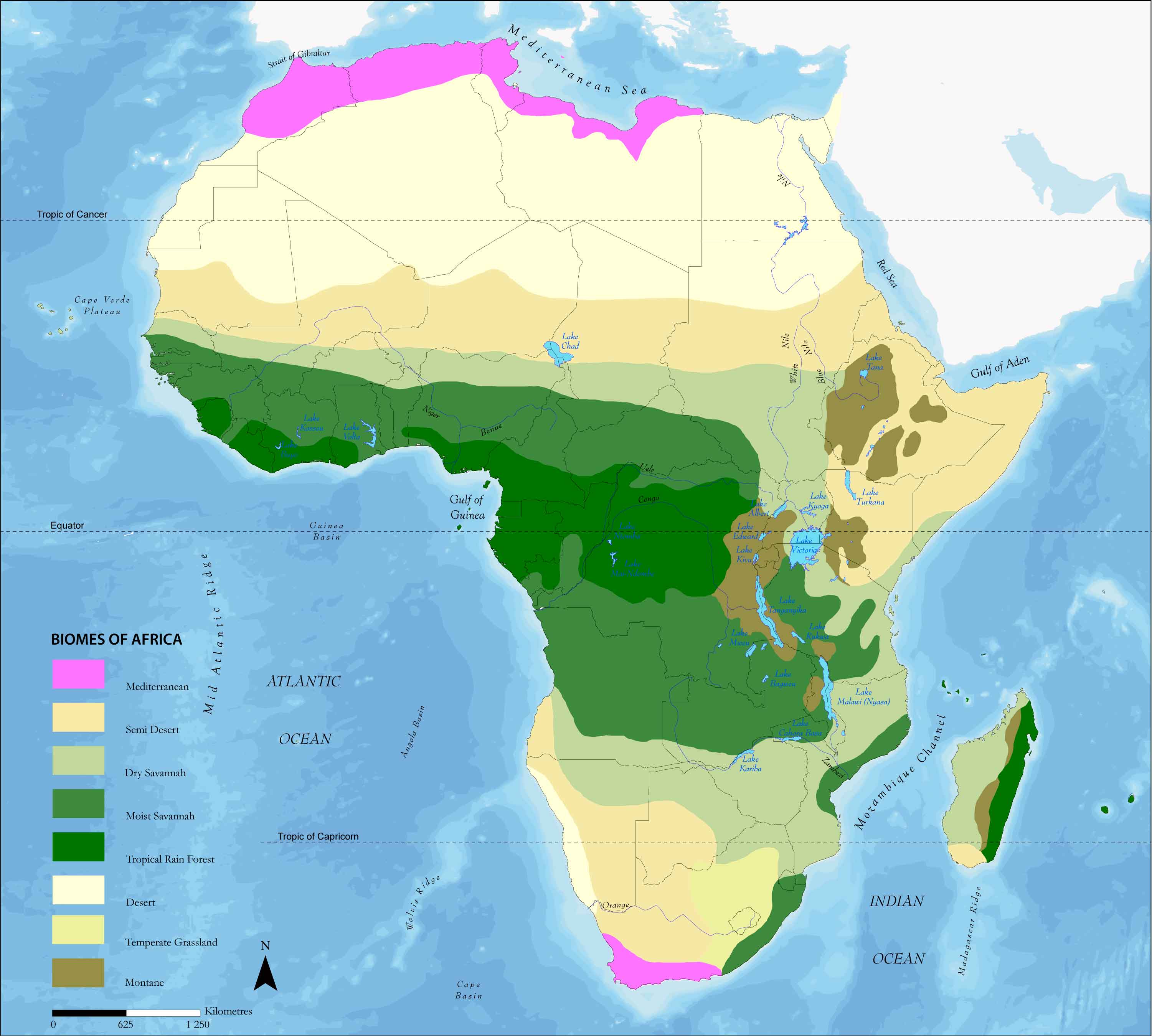
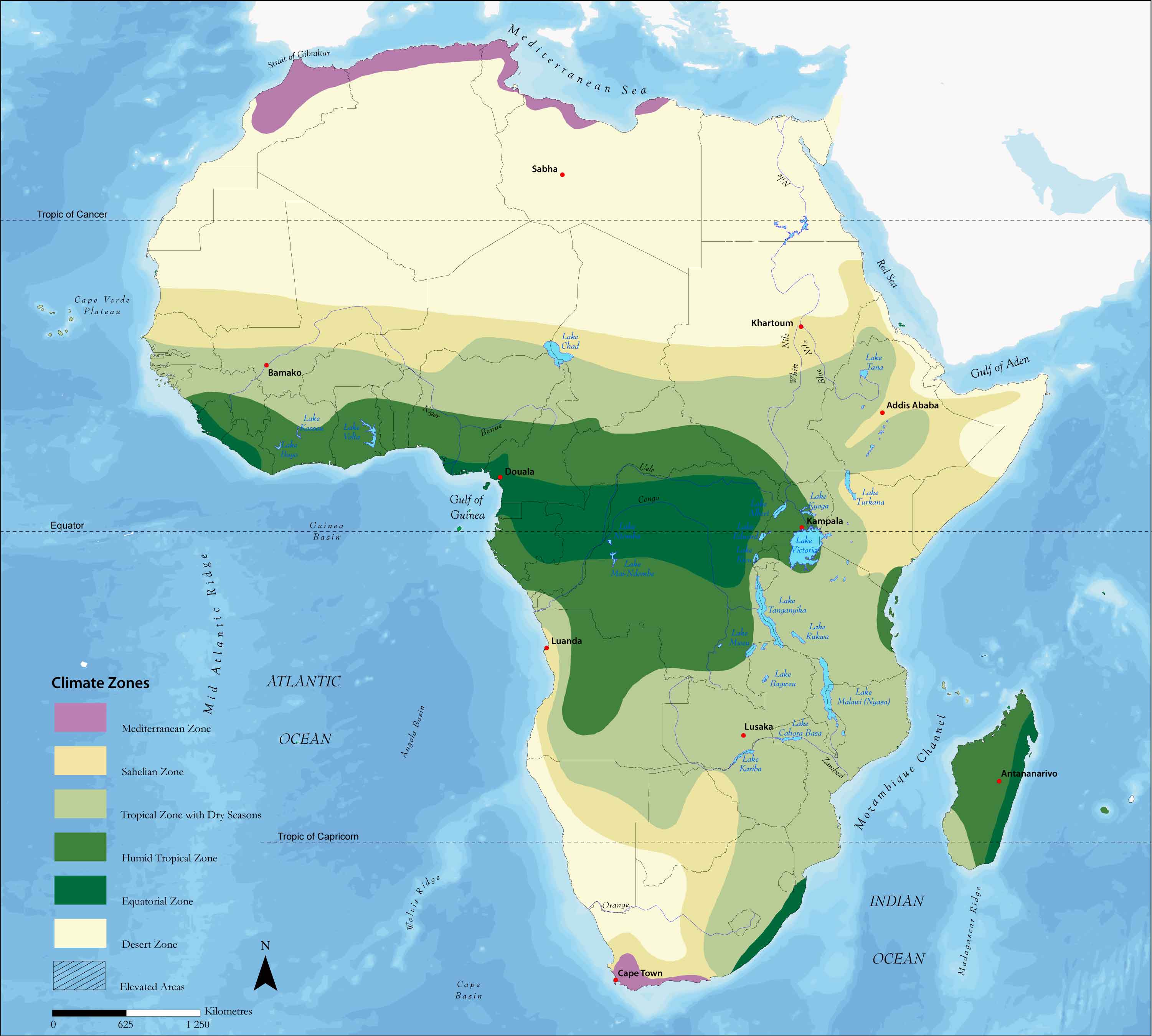
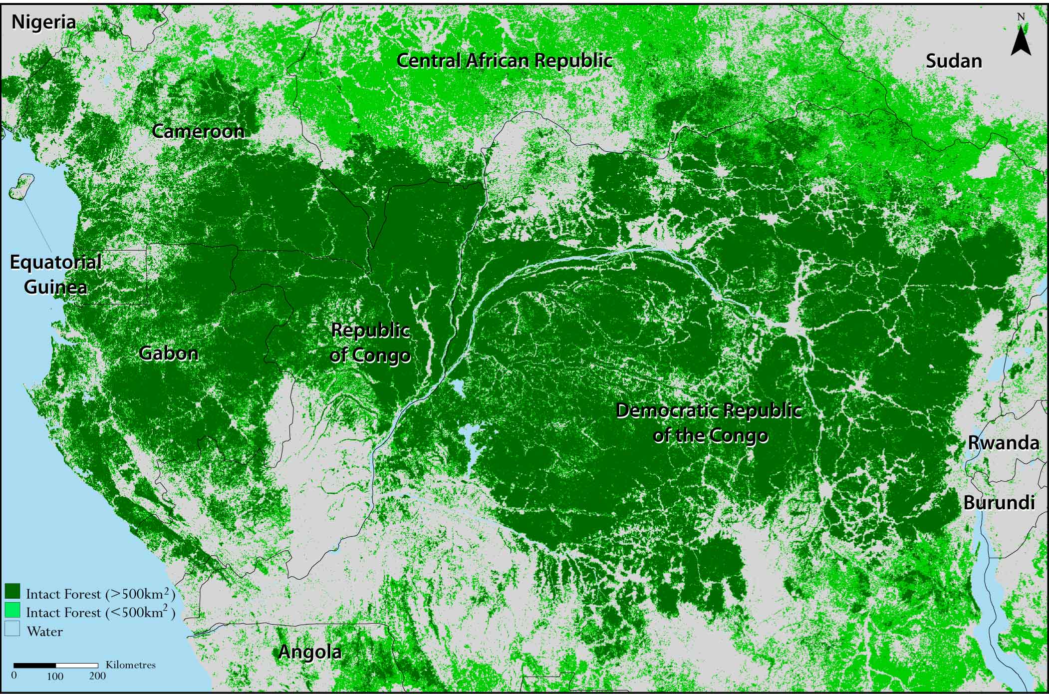
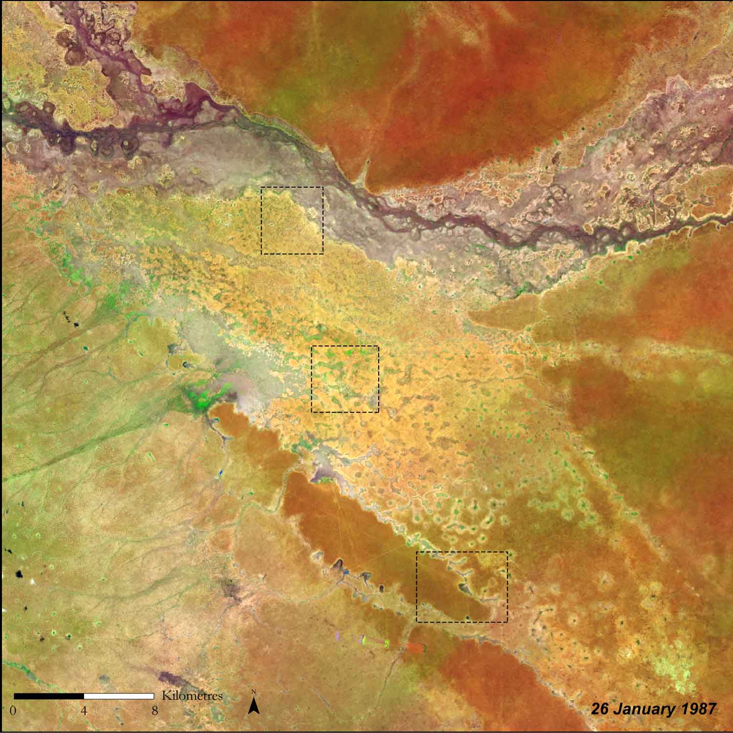
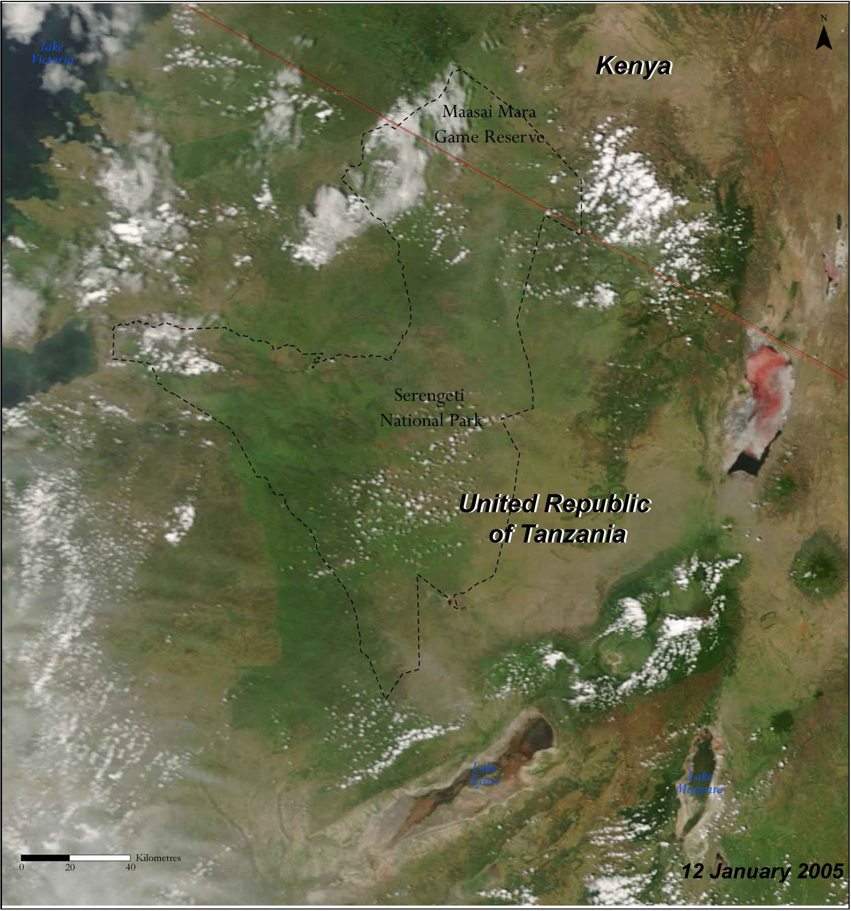
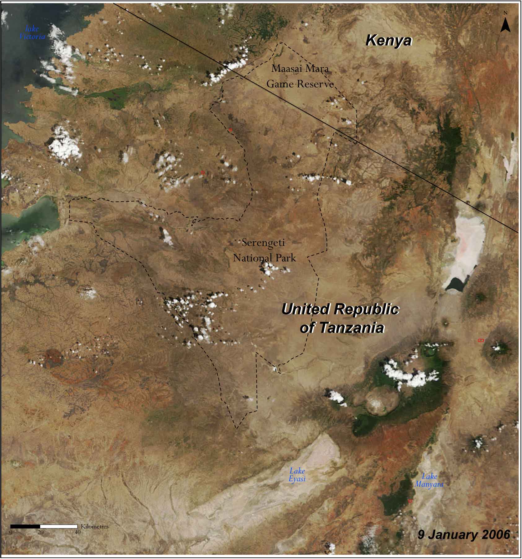
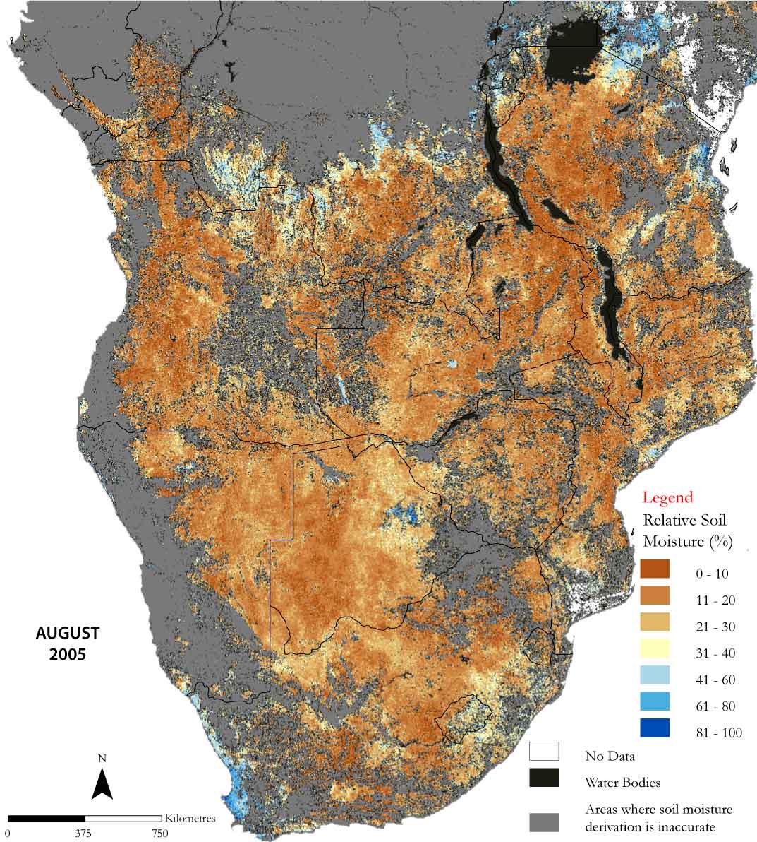
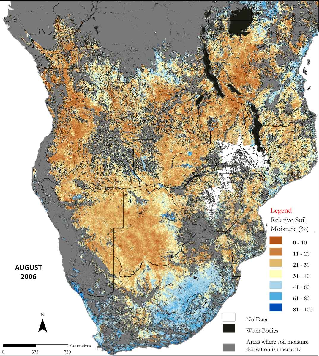
this stunning 400-page “Africa: Atlas of our Changing Environment”
is a unique and powerful publication which brings to light stories
of environmental change at more than 100 locations spread across
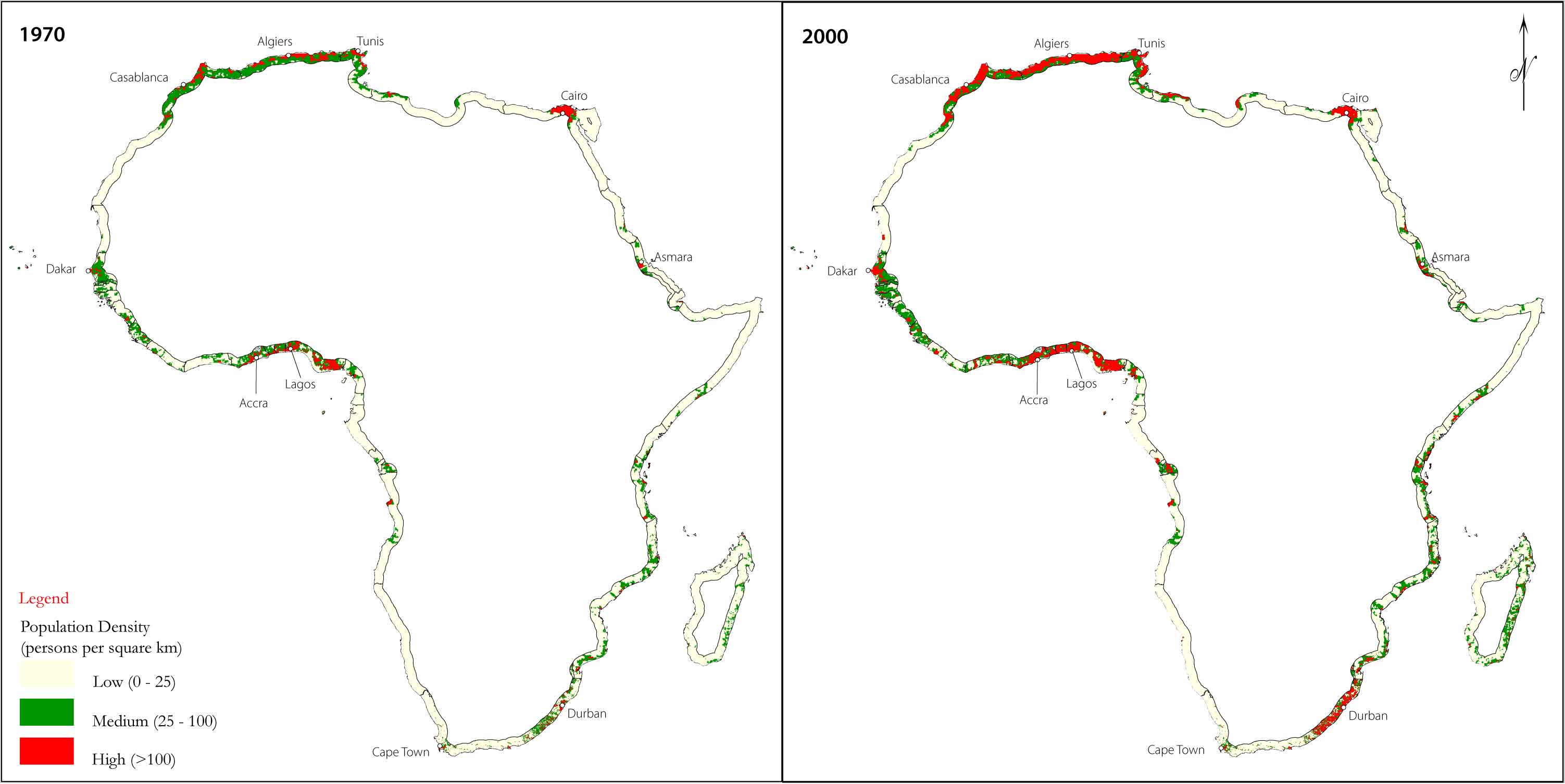
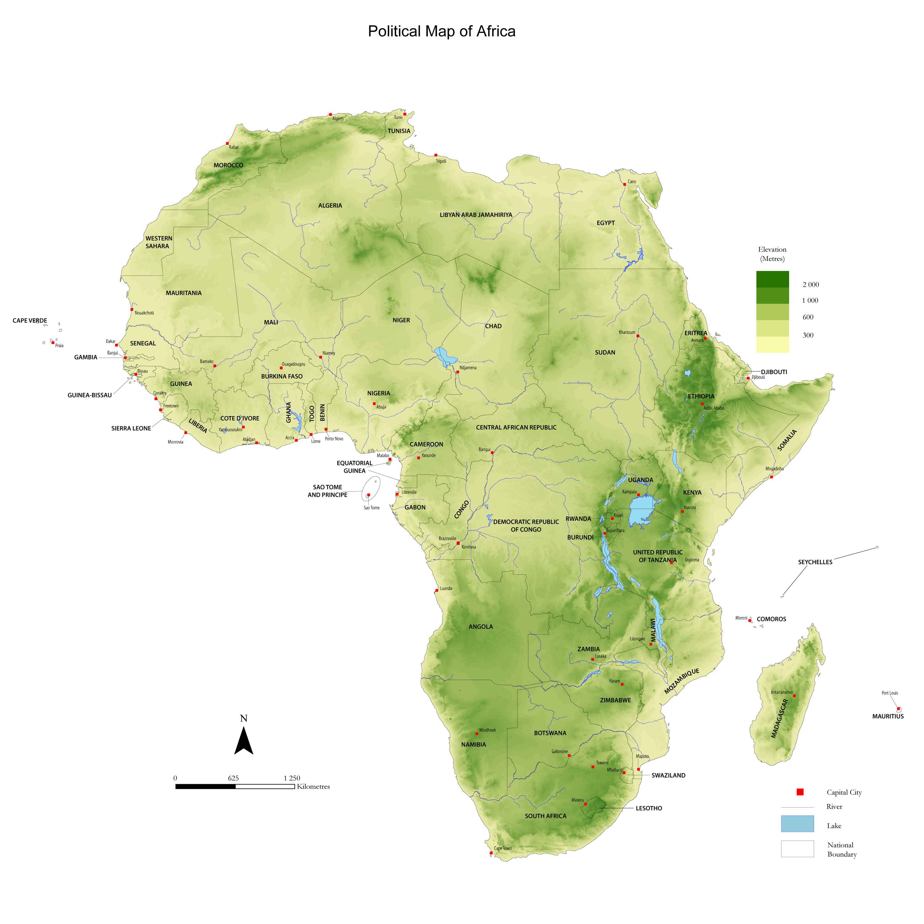
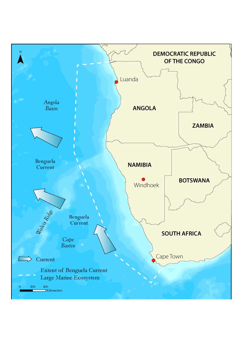
every country in Africa. There are more than 300 satellite images,
300 ground photographs and 150 maps, along with informative graphs
and charts that give a vivid visual portrayal of Africa and its
changing environment. This Atlas underscores the importance of
developing, harnessing and sharing technologies that help provide
deeper understanding of the dynamics of the changes. The words and
pictures within these pages also serve as a vivid reminder that
Africa's environment is a source of livelihoods from many African
communities. It contributes significantly to socio-economic
development of the continent, and sound policy decisions and
positive actions by societies and individuals are needed to sustain
the environment and the well-being of its inhabitants. The
information provided will not only be useful in the context of the
selected locations, but will also underscore the intrinsic value of
the harnessing, visualizing and communicating technologies to gain a
deeper understanding of the dynamics and impacts of Africa's
changing environment. |